Investigations with Drones in BC
Aerial Surveillance • Investigation • Thermal & Optical Imaging
Real-World Use of Drones in Investigations in 10 Industries for Aerial Vista
Drones aren’t just for beautiful aerial shots—they’re rapidly becoming indispensable tools in professional investigations across a wide range of industries. At Aerial Vista Productions, we’ve seen first hand how aerial intelligence is changing the game. Here are 10 key niches where we use drones are how they are proving their worth in investigative work:
1. Insurance Claims & Fraud Detection
Drones are used to assess damage quickly and accurately after disasters (fires, floods, storms). Insurers rely on high-resolution drone imagery to verify claims, detect fraud, and speed up settlement times. Forensic-level documentation can help validate or dispute suspicious cases—saving millions annually.
2. Investment Due Diligence with Drones
Before major investments in commercial properties, agricultural land, or industrial assets, investors use drones to perform environmental scans, assess wear-and-tear, and verify land usage. This allows investors to validate seller claims and make smarter capital allocations.
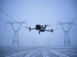
3. Asset Management & Infrastructure Monitoring
Large corporations and governments use drones to track the condition and location of valuable assets—like pipelines, solar farms, wind turbines, or real estate holdings. Regular aerial audits help detect deterioration, unauthorized activity, or compliance risks.
4. Construction Site Investigations
Developers and project managers use drones to monitor site progress, identify safety violations, and document discrepancies between the planned versus actual build. Drones act as impartial observers, especially in contractor disputes or cost overruns.
5. Agricultural & Environmental Investigations
In agriculture, drones identify irrigation issues, illegal pesticide use, or unauthorized land changes. Environmental consultants also use drone imagery to investigate land use violations, erosion patterns, or endangered habitat encroachment.
6. Corporate & Competitive Surveillance
While sensitive, drones can be used (legally and ethically) to monitor competitor activity from public airspace—such as industrial expansion, traffic flow at commercial hubs, or illegal dumping. Companies use this data to assess threats or identify acquisition targets.
7. Legal & Forensic Investigations
Law firms and private investigators rely on drones to document accident scenes, property boundaries, or crime-related evidence. Drones preserve real-time visuals in high resolution, which can become critical exhibits in litigation or insurance disputes.
8. Mining & Natural Resource Verification
Before major mining or logging investments, aerial scans help validate resource claims, check environmental compliance, or confirm operational activity. This protects investors and regulatory bodies from fraudulent or outdated data.
9. Disaster & Emergency Response Analysis
Post-disaster investigations rely on drones to assess damage zones, identify survivors, and prioritize response efforts. Investigative teams later use the data to determine fault, policy violations, or effectiveness of response protocols.
10. Media, Journalism & Public Watchdog Investigations
Investigative journalists and watchdog organizations use drones to uncover hidden environmental damage, track infrastructure neglect, or expose government mismanagement—empowering transparency and accountability through aerial documentation.
Bringing It Together:
Compliance, Confidentiality & Court-Ready Evidence
We strictly follow:
- Transport Canada RPAS regulations for Advanced drone operations.
- BC and Canadian privacy laws for evidence gathering.
- Industry best practices to ensure footage integrity and chain of custody.
All our pilots hold Advanced RPAS certification and our work is fully insured.
We provide time-stamped, unaltered source files that meet evidentiary standards for legal proceedings.
Example Outcomes
- Insurance Case – Thermal imaging revealed concealed water damage, leading to claim resolution in days.
- Construction progress– 3D mapping shows monthly site progress
- Environmental Enforcement – Aerial surveillance identified illegal dumping, enabling swift regulatory action.
BC-Wide Service Area for Specialty Drone Services:
We serve clients in:
- Vancouver & Whistler
- Squmaish & Lower Mainland
- Victoria & Vancouver Island
- Kelowna, Kamloops Interior BC
- Prince George, Terrace
- Prince Rupert and Northern BC communities
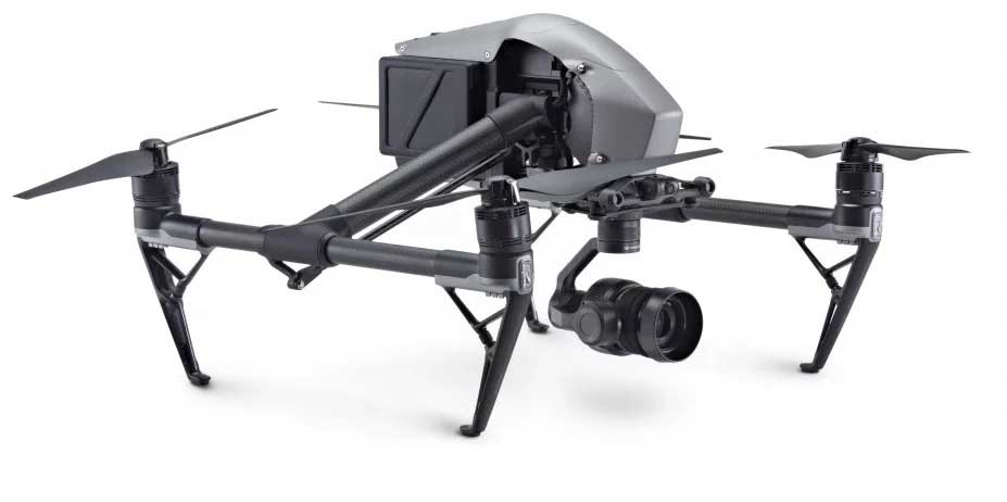
We operate state-of-the-art drones equipped with:
High-Resolution Cameras – 20MP+ stills, 4K/6K/8K video capture.
Thermal Imaging Sensors – Detect heat patterns invisible to the naked eye.
Zoom Lenses – Capture identifying details from safe stand-off distances.
3D Mapping & Photogrammetry – Create accurate 3D models
Each of these industries benefits from one powerful drone advantage: a new vantage point that saves time, reduces risk, and increases accuracy. At Aerial Vista Productions, we help clients turn this potential into results—whether you’re validating a claim, protecting an investment, or uncovering the truth from above.


